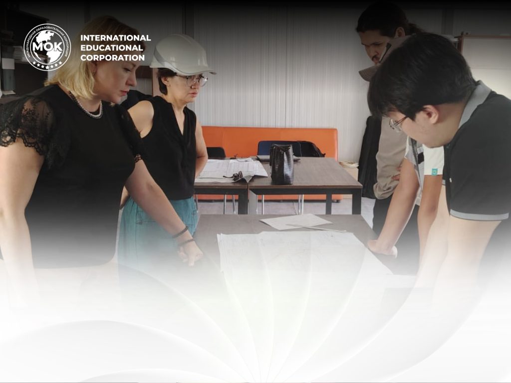
IEC Faculty Completed Internship at Samruk-Kazyna Construction
From June 16 to 30, the academic staff of the International…

In the early years following the establishment of AIAC, the Technological school was founded, later renamed in 2006 as the Faculty of Construction Technologies, Infrastructure, and Management (FCTIM).
For many years, the faculty was led by distinguished deans:
Academician of the IA RK, Doctor of Technical Sciences, Professor S. Zh. Saibulatov, and Doctor of Economic Sciences Zh. M. Adilov.
The faculty initially comprised the following specialties: Industrial and Civil Construction, Technology of Building Materials, Economics, Accounting and Auditing, and Management.
Since 2006, the faculty has been headed by:
Associate Professor, Candidate of Technical Sciences A. S. Espaeva (2006–2013)
Candidate of Economic Sciences, Associate Professor D. A. Adilova (2013–2017), currently Vice President of the IOC
Candidate of Technical Sciences, Associate Professor Zh. T. Omirzhanova (2017–2018)
Since January 2019, the faculty has been led by Candidate of Technical Sciences, Associate Professor A. S. Estemesova
Currently, the faculty offers six undergraduate programs, six master’s programs, and three doctoral programs.


are structured and organized sets of academic activities, courses, disciplines, or modulesdesigned to achieve specific educational goals. These programs aim to transfer knowledge, develop skills, and build competencies in students.
Welcome to the news section of our faculty! Here, you will find the latest updates on events, achievements, and opportunities available to our students, faculty, and partners.
From June 16 to 30, the academic staff of the International…
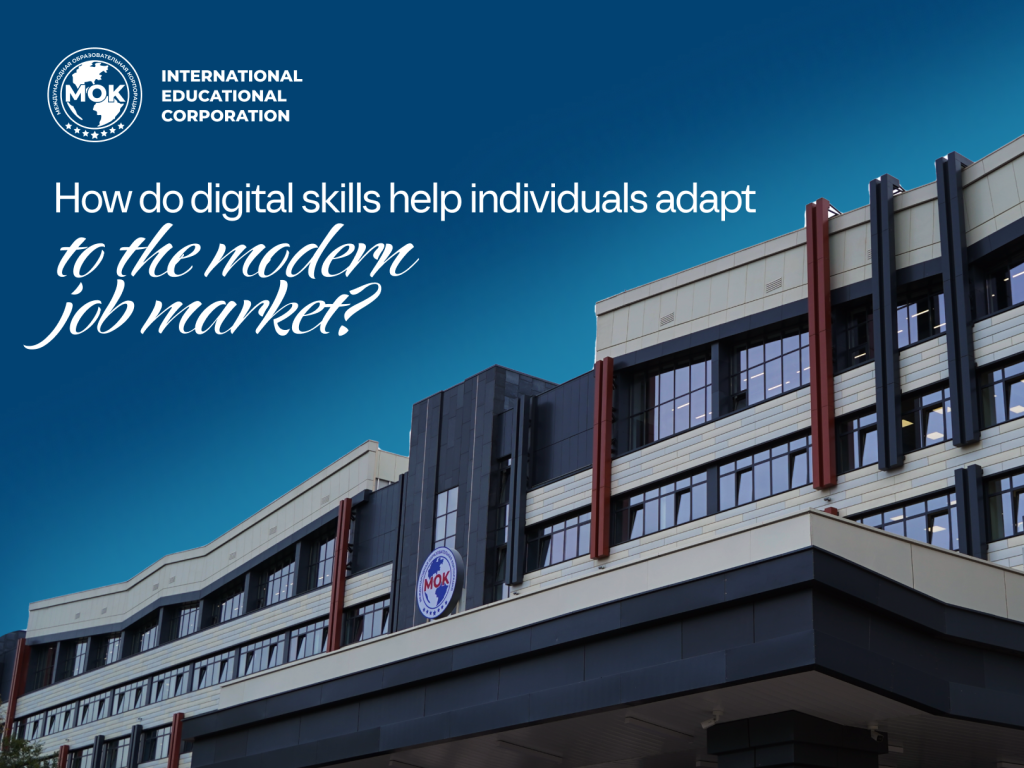
The modern labor market demands not only professional knowledge from young…


Almaty, Bostandyk District, 050043, Ryskulbekov Street, 28
Educational Program 6B07501 – Cadastre
Program Overview:
The aim of the educational program 6B07501 “Cadastre” is to prepare graduates as competitive specialists in the field of land management and cadastre, equipped with critical thinking and the ability to apply theoretical and practical knowledge in land and cadastral works, including:
Land monitoring
Cadastral and economic valuation of land and real estate
Application of regulatory frameworks in project development
Key Disciplines:
Students gain broad professional training in:
Geodesy, cartography, and cadastre
Use of GIS in land relations
Specialized satellite observation methods
Cadastral appraisal of real estate
Objects of Professional Activity:
Land resources of the Republic of Kazakhstan across all categories, types, and forms of ownership and use
Real estate properties located within the boundaries of cities, towns, and rural settlements, regardless of their classification, intended use, or form of ownership
All types of land ownership and land use, including those within urban and rural settlements, irrespective of category or ownership type
Educational Program – Construction Economics and Management
Program Overview:
The Construction Economics and Management educational program is aimed at training highly qualified professionals equipped with the knowledge and competencies necessary for successful work in construction-related organizations.
Graduates are prepared to provide entrepreneurial vision in the context of a developing digital economy, apply modern methods of quantitative and qualitative analysis, model business processes, and plan and manage innovative research projects.
Bachelor’s degree holders in this program acquire all the essential knowledge and practical skills required to operate as mid- and senior-level managers in the construction sector.
Program Objective:
To train specialists with an advanced level of competence in construction economics and management, capable of navigating the specific characteristics of the construction market as a unique segment of the modern economy.
Key Disciplines:
The curriculum includes general education, foundational, and specialized disciplines, such as:
Economics in Construction
Principles of Management
Marketing Fundamentals
Resource Norming and Cost Calculation in Construction
Estimate Development Using Digital Technologies
Project Management and Startups
Time Management
Financial and Managerial Analysis
This practice-oriented and multidisciplinary program also develops core competencies such as:
Planning and organizing creative project teams
Developing modern construction-related projects
Driving the digitalization of the construction economy
Promoting innovation and entrepreneurship
Fields of Professional Activity:
Graduates are prepared to work in:
Construction enterprises and organizations of all forms of ownership
Government and municipal authorities
Research and consulting organizations
National and international design and construction firms
The mission of the program is to meet the growing demand for professionals in construction economics, as well as operational and strategic management within the construction sector.
A key strategic component is the integration of traditional and innovative tools in economics and management, tailored to the needs of the construction market.
Expected Learning Outcomes:
Graduates will be able to:
Efficiently organize and manage economic processes in the construction industry
Develop and implement business projects
Manage finance, resources, and personnel
Apply modern methods of strategic planning, digital technologies, and analytical tools
Operate in full compliance with legal and environmental regulations
Educational Program 6B07371 – Geodesy and Cartography
Program Overview:
The educational program 6B07371 “Geodesy and Cartography” is designed to train qualified specialists ready to work in geodetic and cartographic enterprises, as well as in construction companies, the oil and gas industry, geological exploration, and other key sectors of the economy.
Upon completion of the program, a geodesy and cartography specialist is able to:
Collect, process, and analyze geodetic and remote sensing data
Define goals and identify paths to achieving them using modern scientific methods
Apply core techniques and tools for obtaining data on physical and man-made objects
Use computers and specialized software tools for data storage, processing, and information management
The ultimate goal is to prepare specialists capable of utilizing scientific and spatial data for solving applied problems in:
Territorial development and cartography
Construction and engineering surveys
Natural resource management, using advanced technologies and methods
Core Disciplines:
General geodetic training
General cartographic training
Remote sensing and spatial object analysis
Image processing and photogrammetry
Geodetic monitoring of structures
Satellite geodesy
Applied surveying methods and technologies
Objects of Professional Activity:
The Earth’s surface, including national and specialized geodetic networks
Construction sites for buildings and structures
Civil, residential, transportation, and hydraulic infrastructure
Mineral deposits and exploration zones
Land parcels and urban areas
Natural and human-modified systems
Educational Program – Radio Engineering, Electronics and Telecommunications
Program Overview:
The Radio Engineering, Electronics and Telecommunications educational program is aimed at shaping a well-educated, adaptable, and mobile professional with both core and specialized competencies in telecommunications, capable of solving engineering tasks in the fields of radio technology, electronics, and communication systems.
This program prepares highly qualified specialists for innovative sectors of the national economy in the field of advanced telecommunications technologies.
Graduates acquire theoretical, practical, and research knowledge and skills that meet the demands of both the domestic and global labor markets. They are trained to quickly adapt to constantly changing socio-economic conditions within the context of the growing ICT (information and communication technologies) sector.
Key Subjects:
Introduction to Radio Electronics
Optics
Fundamentals of Electronic and Measuring Equipment
Circuitry and Electronics
Electrical Circuit Theory
Wireless Communication Technologies
Mobile Communication Technologies
Computer Networks in Telecommunications
Computer Networks (Cisco 1)
Fundamentals of Robotics
Computer Graphics Systems
Metrology, Standardization and Certification
Theory of Electrical Communication
Digital Television Systems
Structured Cabling Systems
Information Security in Telecommunication Systems
Broadband Access Systems
Optical Systems in Telecommunications
Fiber-Optic Communication Lines
Digital Communication Technologies
Digital Devices and Microprocessors
Multichannel Telecommunication Systems
Guided Communication Systems
Antenna and Feeder Devices
NGN and Post-NGN Networks
Routing and Switching in Telecommunications
Satellite and Space Communication
Electromagnetic Wave Transmission Theory
Digital Transceiver Devices
Radio Engineering Devices
Career Opportunities:
Graduates of the program are well-prepared for roles in:
Installation and commissioning
Project management and technical operations
System design and technology development
Engineering analysis and telecommunications research
Service and maintenance operations
Typical positions include:
Cellular communication engineer
Fiber-optic system (FOTS) design engineer
Equipment developer with neural network-based control systems
Hardware design engineer
Telecommunications technology engineer
Information security and technical protection engineer
Graduates find employment with:
Electronics manufacturing companies
Telecom service providers and mobile operators
Repair and maintenance facilities
Research and development institutes
Law enforcement agencies
Defense and aerospace industries, and more.
Educational Program – Production of Construction Materials, Products and Structures
Program Objective:
To train highly qualified and competitive specialists for the construction industry, capable of developing high-tech solutions in the production of construction materials, products, and structural elements.
Graduates will be equipped to apply their knowledge in practice, and will possess both professional and general cultural competencies necessary for effective work in the field.
Core Disciplines:
Engineering Systems in Buildings and Structures
Fundamentals of Architecture and Structural Design
Construction Ceramics I–II
Silicate Materials
Thermal and Acoustic Insulation Materials
Waterproofing and Sealing Materials
Decorative and Finishing Materials
Concrete Technology I–II
Automation of Production Processes
Design of Industry-Specific Enterprises
Economics and Management in the Production of Construction Materials
Minor Program Disciplines:
Technology and Organization of Construction
Design of Buildings and Structures
Digital Design in Construction
Fields of Professional Activity:
Graduates of the program can work in:
Enterprises producing construction materials, products, and structures
Construction sites and companies
Research and design institutes
Accreditation and certification bodies for construction products
Vocational education institutions
Educational Program 6B07211 – Woodworking Technology and Wood Products (by Areas of Application)
Program Overview:
The educational program 6B07211 “Woodworking Technology and Wood Products (by Areas of Application)” is designed to train qualified specialists capable of working in woodworking enterprises, furniture factories, construction companies, and related industries involved in the processing and production of wood-based products.
Upon completion of the program, graduates are able to:
Design, manufacture, and ensure quality control of wood products
Set project goals and identify methods to achieve them using modern research techniques and innovative technologies
Master core methods, tools, and technologies for wood processing and product manufacturing
Utilize specialized software tools for computer-aided design, data processing, and production management
The ultimate goal is to prepare highly skilled professionals in the field of wood technology, capable of applying scientific knowledge to analyze and solve industry-specific tasks in furniture production, wooden construction, interior and exterior wood applications, and forest resource management using modern engineering and digital solutions.
Key Disciplines:
Students study a wide range of subjects aimed at developing core competencies for the industry, including:
Wood Science
Modern Materials in Furniture Production
Woodworking Machinery and Equipment
Design of Wood-Based Products
Professional Computer Software
Design of Woodworking Facilities
Wood Product Manufacturing Technology
Wood Finishing Techniques
Economics and Management in the Furniture and Woodworking Industry
Fields of Professional Activity:
Graduates of the program are qualified to work in:
Furniture factories and woodworking enterprises
Design and engineering studios
Companies specializing in the production and processing of wood materials
Construction firms engaged in timber housing and structural wood components
Research institutes and educational institutions
Expected Learning Outcomes:
Graduates will be able to:
Develop and implement innovative solutions in woodworking production
Design wood products and manufacturing processes using modern digital tools
Ensure the quality and compliance of materials with relevant standards
Assess the economic efficiency and environmental safety of production
Apply automated systems and engineering design tools
Manage resources and production activities effectively
Educational Program 6B07212 – Engineering in the Woodworking and Furniture Industry
Program Overview:
The educational program 6B07212 “Engineering in the Woodworking and Furniture Industry” is aimed at training innovation-oriented specialists capable of solving practical and technical challenges in the woodworking and furniture production sectors.
Upon graduation, a specialist in this field will be able to:
Design, manufacture, and control the quality of wood-based products
Set goals and determine strategies using modern scientific methods and innovative technologies
Apply key methods and tools for wood processing and product manufacturing
Use computer-aided design (CAD) software and digital tools for data management and production optimization
The ultimate goal of the program is to provide high-quality professional training in engineering for the woodworking and furniture industry, preparing graduates to analyze and solve industry-related tasks in furniture manufacturing, wooden construction, interior and exterior design, and forest resource management, utilizing advanced technologies and modern engineering solutions.
Key Disciplines:
Students will gain comprehensive knowledge and skills through courses such as:
Modern Materials for Furniture Manufacturing
Joint Systems and Mechanisms in Furniture Production
Professional CAD Software for Furniture Design
3D Modeling Software for Wood Products
Architectural and Structural Design of Woodworking Facilities and Complexes
Intelligent Manufacturing Systems in Wood Processing
Business in the Furniture and Woodworking Industry
Fields of Professional Activity:
Graduates of the program may work in:
Furniture factories and woodworking enterprises
Design and engineering studios
Companies specializing in wood materials and products
Construction firms producing wooden houses and structures
Research institutions and educational organizations
Their own entrepreneurial ventures in furniture and wood production
Expected Learning Outcomes:
Graduates will be able to:
Demonstrate professional thinking and apply knowledge of technical documentation, automation, and materials science
Design and optimize technological processes
Ensure environmental safety and compliance with quality standards
Apply modern technologies and equipment in the woodworking and furniture industries
Develop and implement innovative products and solutions
Manage production processes efficiently using principles of management and entrepreneurship
Educational Program – Computer Systems and Software
Program Objective:
To train highly qualified specialists in the field of computer systems and software, equipped with fundamental knowledge in information technologies and capable of applying conceptual understanding and engineering skills to design and develop software, computing systems, and information systems.
Learning Outcomes:
Graduates will be able to:
Ensure occupational safety and conduct technical and economic analyses with justification of managerial decisions
Develop standard algorithms (linear, conditional, loop-based, recursive) and programs in object-oriented programming languages; work with data structures, files, and design interactive user interfaces
Design and develop ergonomic user interfaces
Use various information and communication technologies in professional activities, including Internet resources, cloud services, and mobile platforms for information retrieval, storage, processing, protection, and dissemination
Design the architecture of databases, software, and information systems
Install, configure, test, and maintain system and application software for computer systems and networks
Apply modern programming environments, tools, and techniques
Demonstrate proficiency in the lexical and grammatical norms of Kazakh (or Russian) and a foreign language, and communicate effectively in monologue and dialogue formats for solving professional tasks
Develop and/or apply software, hardware, informational, mathematical, and functional solutions for information systems, including modeling algorithms and methods
Justify the selection of industry standards, design principles and patterns, programming methods, tools, and languages, including the choice of information security mechanisms for modern ICT systems
Demonstrate knowledge of social and ethical norms, the role of social processes, interpersonal and legal considerations, and rights protection in professional practice
Apply basic mathematical and natural science knowledge in an interdisciplinary context to solve IT-related professional tasks
Educational Program – Construction Engineering, Inspection and Technical Supervision
Program Overview:
This program is designed to train highly qualified specialists for the construction industry, equipped with the essential knowledge and skills for design, project management, and execution of various infrastructure projects, buildings, and structures.
Graduates will be able to:
Oversee the quality and progress of construction works
Select appropriate building materials and equipment
Manage construction budgets
Ensure compliance with construction codes, safety regulations, and technical documentation deadlines
Field of Study:
B074 – Urban Planning, Construction Works and Civil Engineering
Unified National Testing (UNT) subjects: Mathematics and Physics
Career Paths:
Graduates of this program may pursue careers in:
Technical documentation development
Technical design of innovative products and services
Architectural and urban planning
Construction project development
Production management in construction
Facility maintenance and building operations
This program provides comprehensive training for a successful career in the construction sector, developing the competencies required to effectively meet professional challenges in a modern construction environment.
Educational Program 7M07362 – Production of Construction Materials, Products and Structures (Professional Track)
Program Objective:
The objective of this program is to train highly qualified specialists capable of solving technological challenges in the production of construction materials and products, and to prepare them to successfully compete in the labor market.
Fields of Professional Activity:
Graduates may work in:
Construction material manufacturing enterprises
Design and engineering organizations
Research institutes
Certification laboratories
Construction companies
Potential job positions include:
Laboratory Director
Chief Technologist
Head of Production or Supply Departments
Waste Processing Engineer
Learning Outcomes:
Graduates of this program will be able to:
Demonstrate trilingual proficiency (Kazakh, Russian, English) for effective professional communication and management
Apply entrepreneurial competencies and understand market-oriented technologies
Analyze and assess enterprise development strategies
Participate in scientific research and its commercialization
Collaborate in team settings to address current industry challenges
Possess knowledge of modern technologies for the production of high-performance construction materials
Use information technologies for analytical and reporting tasks
Apply material modification techniques, including nanomodification
Manage quality assurance and optimize technological processes
Understand and apply fundamentals of materials science
Develop new materials in accordance with the principles of sustainable construction
Implement energy-saving and resource-efficient practices in manufacturing
Master’s Program: Economics and Management in Construction (Scientific and Pedagogical Track)
Program Overview:
This educational program is designed to train specialists with a focus on scientific, methodological, and applied teaching practices, integrating the modern development experience of the construction market. It combines both theoretical foundations and professional standardization, preparing graduates to become professionals who embody the qualities of both researchers and practitioners in economics and management, with strong creative potential in scientific inquiry.
Program Objective:
To develop theoretical knowledge, practical skills, and competencies in the economics and management of construction enterprises, enabling graduates to operate successfully in research-oriented market environments.
Key Courses and Learning Format:
The core of the master’s curriculum includes:
Author’s special courses
Scientific seminars led by professors
Guest lectures and masterclasses from renowned scholars and industry professionals
Scientific and applied research is conducted under the guidance of Kazakhstani and international research schools, alongside practical training at construction enterprises and organizations.
Core academic subjects include:
Methodology of Scientific Research
Foundations of Entrepreneurship and Management
Product and Service Evaluation
Enterprise Investment Activity Organization
Creative Management
Financial Risk Assessment in Construction
Professional Fields of Activity:
Graduates of the master’s program 7M07324 – Economics and Management in Construction can successfully pursue careers in:
Higher education institutions
Construction enterprises and organizations of all ownership types
R&D and design institutes focused on scientific progress and innovation
Creative and consulting projects within both Kazakhstani and international companies
Economics and Management in Construction (Professional Track)
This program is aimed at preparing highly qualified scientific and pedagogical specialists in the field of economics and management for the construction industry. Graduates will possess modern knowledge and skills in areas such as business planning, investment project management, cost management, and cost estimation in construction. Special attention is given to the ability to adapt education and scientific research to the evolving needs of society and advancements in scientific thought.
Program Duration: 1 year
Main Areas of Study:
Project Management:
Graduates will be able to effectively manage construction projects, including planning, implementation, and monitoring progress.
The master’s program equips graduates with the necessary competencies for a successful career in construction project management and scientific-pedagogical activities, shaping professionals capable of adapting to changes in the industry and making significant contributions to the development of the construction sector.
7M07211 – Woodworking Technology and Wood Products (By Application Areas)
This program is aimed at preparing qualified specialists ready to work in woodworking enterprises, furniture factories, construction companies, as well as industries related to the production and processing of wood.
Upon completing this program, the graduate will be involved in designing, producing, and quality control of wooden products. They will set goals and choose ways to achieve them using modern scientific research methods and innovative technologies. The graduate will have expertise in the basic methods, techniques, and tools for wood processing and manufacturing wooden products. Additionally, they will be proficient in using computer systems for storing, processing, and managing information, utilizing specialized software for design and analysis. Their responsibilities will include developing technical projects for performing woodworking tasks based on modern methods and tools to address specific professional challenges, as well as overseeing and controlling the implementation of projects. The graduate will also be skilled in working with modern equipment and wood processing technologies, as well as interpreting the obtained data. Woodworking technology specialists also interact with clients, make management decisions in non-standard situations, and take responsibility for those decisions.
The ultimate goal is to prepare scientific and scientific-pedagogical personnel for universities and research organizations, with in-depth academic and research training. The program aims to develop general cultural, professional, and specialized competencies necessary in the field of woodworking and wood product manufacturing.
Key Courses of the Program:
Fundamentals of Scientific Research
Modeling and Optimization of Woodworking Processes
Current Issues in Woodworking Production Processes
Patent Research and Intellectual Property Protection
Advanced Technologies in Woodworking
Professional Activity Areas:
Graduates can work in:
Furniture factories and woodworking enterprises
Design and project bureaus
Manufacturing companies producing and processing wood materials
Construction companies producing wooden houses and structures
Graduates with scientific-pedagogical training can work as researchers in research and design organizations, or as lecturers in higher education institutions.
Learning Outcomes for the Program:
Develop and implement management technologies for strategic development of organizations.
Use foreign languages to analyze scientific and technical information.
Apply psychological management methods.
Control the quality of products in woodworking production.
Develop and implement modern technologies for manufacturing wood products.
Design and modernize woodworking production.
Develop technological documentation using modern tools.
Analyze and develop organizational strategies based on cutting-edge scientific achievements.
Demonstrate knowledge of advanced technologies and modern equipment in woodworking.
Woodworking Technology and Wood Products (By Application Areas)
The main goal of this educational program is to prepare highly skilled specialists with modern knowledge and skills to solve complex technological tasks in the field of woodworking. The program is designed to develop students’ ability to adapt to rapidly changing labor market conditions and successfully compete in the woodworking and wood products manufacturing sectors.
Duration of Study: 1 year
Learning Outcomes:
Mastery of advanced technologies and processes in woodworking.
Ability to develop and optimize technological processes.
Skills in conducting techno-economic analysis and justifying management decisions.
Proficiency in working with modern production management systems.
Readiness for independent scientific and research activities in the field of woodworking.
The Master’s program in Woodworking Technology provides unique opportunities for professional growth and prepares specialists who can make significant contributions to the development of the industry.
Geodesy (Scientific and Pedagogical Track)
The 7M07371 – Geodesy educational program prepares qualified specialists who are ready to work in cartographic-geodetic enterprises, as well as in construction companies, oil and gas, geological exploration, and other sectors of the economy.
Upon completion of this program, a geodesy and cartography specialist will be engaged in the collection, generalization, and analysis of geodetic and aerospace information. They will set goals and choose ways to achieve them using modern scientific methods. The specialist will master the main methods, techniques, and tools for obtaining information about an object, and will be proficient in using computer systems for storing, processing, and managing information, utilizing software products. Their tasks include the development of technical projects for cartographic and topographic-geodetic works based on modern methods and tools to solve specific professional tasks. They will manage and control the execution of projects, process aerospace data, and interpret the obtained data. The geodesy specialist will also work with clients, make management decisions in non-standard situations, and be responsible for them.
Main Goal:
The goal of the program is to prepare scientific and scientific-pedagogical personnel for universities and research organizations with advanced research and pedagogical training. The program focuses on the development of general cultural, professional, and specialized competencies necessary in the field of geodesy.
Subjects Studied in the Program:
Fundamentals of Scientific Research Philosophy
Geodetic Research and Positioning
Geoinformation Systems
Modeling Processes and Phenomena
Remote Sensing and Image Analysis
Engineering-Geodetic Monitoring and Data Management
Professional Activity Objects:
Objects located on the Earth’s surface
Mineral deposits and natural resources, which are objects of subsoil use and scientific study in mineral resource organizations
Construction sites
Oil and gas extraction companies
A Master in Geodesy with a scientific-pedagogical focus can work as a researcher in research and design organizations or as a faculty member at higher educational institutions.
Training of Qualified Specialists in Geodesy (Specialization Track)
The preparation of qualified specialists involves comprehensive training, providing deep theoretical knowledge in geodesy as well as practical skills necessary to perform professional tasks. The goal is to develop specialists capable of effectively working in various production environments, managing projects, and organizing and coordinating the activities of working groups.
The training focuses on developing general cultural and professional competencies, including:
Theoretical Training:
Mastering the fundamentals of geodesy, cartography, topography, and related disciplines.
Studying modern methods and technologies for accurate measurements and data processing.
Understanding the regulatory and legal aspects governing geodetic activities.
Practical Training:
Working with modern geodetic equipment (electronic total stations, GPS receivers, drones, etc.).
Mastery of specialized software for data processing and the creation of cartographic products.
Solving real-world tasks in both field and laboratory conditions.
Educational Program 8D07371 – GeodesyThe educational program 8D07371 is aimed at training highly qualified researchers in the field of geodesy. Graduates of this program will possess the knowledge and skills required for collecting, summarizing, and analyzing geodetic and aerospace information using advanced information technologies, methods of mathematical and computer modeling, and modern research methods for effectively solving professional tasks. Graduates will also be capable of transferring their knowledge and experience into teaching activities at higher education institutions.The program ensures an individual approach to students, transforming professional competencies from professional standards and qualification standards into learning outcomes. It applies a student-centered approach, shifting the emphasis in the educational process from teaching (the role of the instructor in “transmitting” knowledge) to learning (as an active educational activity of the student).Goal:
The goal of the program is to train scientific and pedagogical professionals who are highly qualified and competitive in the international labor market in the field of geodesy, possessing high levels of general and professional culture. Graduates will be capable of conducting scientific research and innovation activities, mastering the methodology, and having the skills to transfer knowledge to students in higher education institutions.Key Disciplines in the Program:
Objects of Professional Activity:
Educational Program 8D07211 – “Woodworking Technology and Wood Products (by Application Areas)”
This educational program is designed to prepare qualified researchers in the field of design, production, and quality control of wood products using advanced information technologies, mathematical and computer modeling methods, and modern research methods to effectively solve professional tasks. It also prepares specialists capable of transferring knowledge and experience to teaching activities in higher education institutions.
The program applies an individualized approach to learning, ensuring the transformation of professional competencies from professional standards and qualification standards into learning outcomes. It implements student-centered learning – an educational principle that shifts the focus of the educational process from teaching (as the primary role of the teaching staff in “transmitting” knowledge) to learning (as the active educational activity of the student).
The ultimate goal of this educational program is to prepare high-skilled and competitive scientific and pedagogical professionals for the international labor market in the field of woodworking technology. These professionals will possess a high level of general and professional culture, be capable of scientific research and innovative activity, and have the methodology and skills to transfer knowledge to students in higher education institutions.
Disciplines Studied in the Program:
Research methods
Materials science and the technology of new innovative materials
Current issues in enhancing professional potential
Innovation activities in enterprises
Ecology and rational processing of wood raw materials
Objects of Professional Activity:
All objects related to wood processing and production
Interdisciplinary scientific tasks: development of methods to improve and optimize woodworking technologies, creation of new materials and structures made of wood, and determining their quality and durability parameters.
Short Description of Learning Outcomes for Program “8D07211 – Woodworking Technology and Wood Products (by Application Areas)”: Graduates will demonstrate deep knowledge in technology transfer and scientific research, apply innovative approaches to the development and implementation of new wood materials, predict the outcomes of innovation activities, critically analyze complex ideas and phenomena, generate solutions to current problems, use high-tech methods in professional activities, demonstrate leadership qualities, and contribute to the advancement of technological, social, and cultural development in society.